June 20, 2018
History
Navajo Lake is the second largest lake in the state of New Mexico, with multiple campgrounds, two marinas, and two boat docks. Navajo is a haven for boaters of every stripe – motorized boaters, canoers, kayakers, water skiers and sailors. Navajo Lake State Park offers some of the best boating, fishing, hiking, and camping in New Mexico.
The Navajo Lake Marina was named the “Large Marina of the Year” by Marina Dock Age Magazine, besting more than 1,200 marinas nationwide.
Park Elevation 5,600 – 6,600 ft.
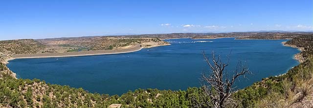
Navajo Lake is a reservoir located in San Juan County and Rio Arriba County in northwestern New Mexico. Portions of the reservoir extend into Archuleta County in southern Colorado. The lake is part of the Colorado River Storage Project, which manages the upper reaches of the San Juan River. The San Juan River is a world-class fly fishing destination and features a campground, day-use areas and a serene trail along the river. Water is impounded in Navajo Lake by the earth-and-rock filled Navajo Dam, 3,800 feet long and 400 feet high, completed in 1962. The 15,600-acre lake is over 25 miles long; the water volume is 1,708,600 acre-ft. and lies at an elevation of up to 6,085 feet. A BIG, BIG LAKE!
The construction of the dam and the resulting lake flooded and destroyed one of the Navajos’ most sacred sites.
Two shoreline areas near the dam in New Mexico are part of the Navajo Lake State Park, featuring over 200 camping and picnic sites, and two improved boat ramps and two marinas. The river shoreline below the dam is also part of the State Park, as well as a BLM Recreation Area. An area in Colorado near the head of the lake is the Navajo State Recreation Area. The lake is an excellent destination for camping and general boating, as well as Smallmouth Bass, Black Crappie, Northern Pike, Channel Catfish, and Trout fishing.
Camping
Leaving Cochiti Lake we travel north toward Chama where we take Hwy 84/64 west through Dulce and then 17 miles north on 527 to Navajo Lake State Park. On our way down to the campground we see hundreds of oil/gas drilling going on. We have not seen this much activity of this kind since leaving Trinidad, CO, and again in South Dakota in 2016 when we went to the UP (Upper Peninsula) on our way to Copper Harbor, Michigan.

The landscape in this part of New Mexico is dry with Pinions, Junipers, sagebrush and cactus affording cover for the Jack Rabbits (which are HUGE), Patti says they look more like kangaroos than rabbits except for the huge ears. I’m sure rattlesnakes live here also, but luckily we did not see any during our stay.
As we arrived at Sims Mesa Campground we wandered around and found the perfect spot, or so we thought. I realized I needed to go around the ‘circle’ again as we were not lined up properly to back the RV in. Patti gets out to check the site and hold it, while I go around again… I stop about 20 feet away, because I see a white truck pull into the space we are going to take. Patti tells them, “WE are taking THIS spot”, and the lady says, “it’s a good thing you (Patti) got out or we would have taken this spot.” They do leave as I watch – then I proceed to approach the site from a better angle. On RV’s or Travel Trailers, all the essentials are on the driver’s side, which means the electric cord as well. We do have a 30’, 30 amp electric cord and 90% of spaces for RV are planned for this adaptation. Well, at this spot the electrical box is on the passenger side and further than 30 feet away. I tried for about an hour to reposition Rosalita in every which way to get it close enough. I got VERY frustrated by the stupidity of the planners of this park for messing with me. It’s a good thing we carry with us an extension cord and adapter for the 30 amp. We found out later that this loop was developed in 1967, so you know… those who planned this campground, were never going to use it!
It was in the mid 90’s by the time I finally decided to concede and use the extension cord – we left the RV hooked up to the truck and waited till later in the cooler evening to unhook and stabilize. We put out the awning for shade for Rosalita, but the wind-gusts keep trying to make it a kite, so we rolled it in, which made it hotter inside the RV, of course. The gnats were very bad and drove me inside, but they didn’t bother Patti as much so she sat outside in the shade of the covered picnic table and read for a while.
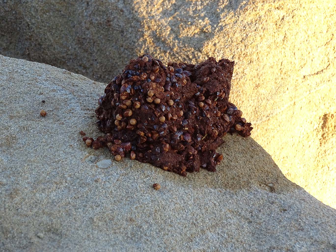
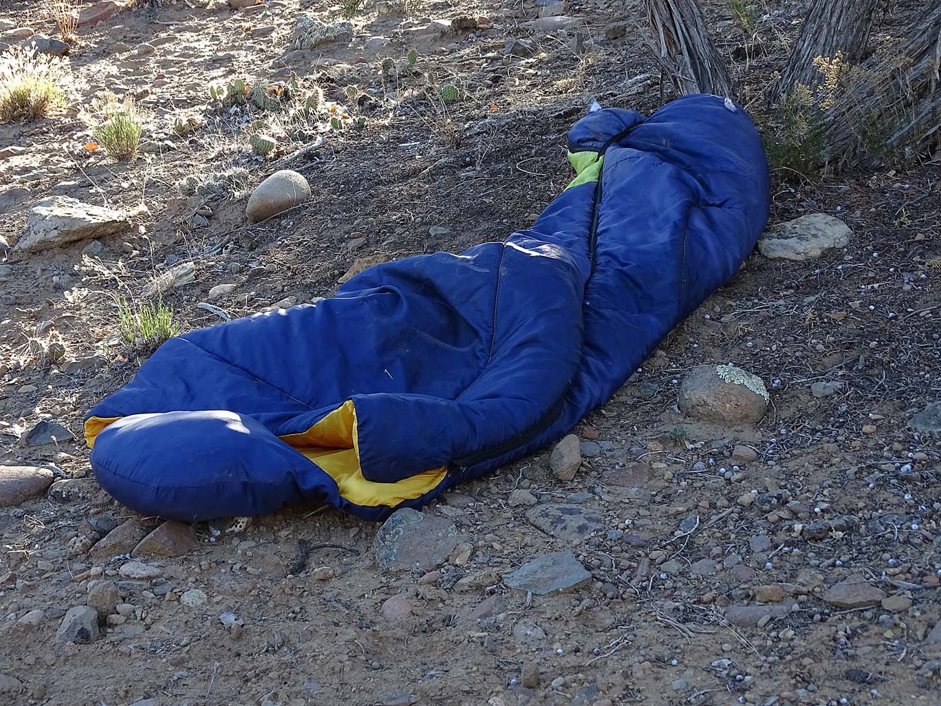
On June 21st, 2018 (the Summer Solstice), I got up early and took a walk (6am) before the heat set in. It was a beautiful morning, cool and no one out and about. It was a pleasant and easy walk to the water’s edge, so still and serene on the water and rocks. I hopped around the rocks looking for interesting and unusual treasures to behold. I saw bear scat, Ospreys soaring overhead looking for breakfast and the ever present signs of humans having passed through the area i.e. trash all along my way. It is so sad that homosapiens leave beer/pop cans, plastic food wrappers and eating implements, cigarette butts, cooler pieces, fishing hooks/accessories, (even a sleeping bag) on the beach. Yes, we leave a trail of trash that will probably outlast the human race. I digress…


A very interesting observation was that on the Summer Solstice 90% of the gnats left… I don’t know where they went – but we were sure glad they left.
The next day, the campground was 90% full and by Saturday the campground was full to overflowing. We decided that this body (large body) of water was the only lake around for miles and miles of semi-desert and so in the summer New Mexicans within a hundred miles come here to cool off and enjoy the coolness of the lake waters, although Colorado is only 26 miles to the north.
Across from our site, there was a group of 8 – 10 college students, camped in tents with a speedboat in tow. They were young and had their music playing, till they left for the day on the water, with their coolers full of beer. Hope they don’t get caught driving and drinking on the water! They would come home late in the afternoon and laugh and play their music, but we did remark, that by 9pm all was very quite, just soft talking. It was so nice to see that they did respect the quiet hours, but I’m sure the beer and sun took its toll on them as well. After the weekend, most left but a few stayed and the campground hosts were quite upset with the way they left their campsite – they broke a fence doing gymnastics from it, as Patti observed. By the end of this weekend, the campground hosts were quite disgusted with how most of the tent-campers left their sites – for they had to clean up after them. Such a shame that people disregard Nature so much and feel others will clean up after them! What have we, as humans, become???
The next day was our next to last day at Navajo Lake and we decided to go to the other side of the lake where the bigger marina and boat ramp are. In order to get there you take a 17-mile journey out to the main highway, then 35 miles north, then 17 miles back in to the lake… OR you could take the Dam Shortcut road – about 12 miles of dirt road ending up going over the Dam and down into the marina. We took the shortcut, which was a birds-eye view around the southwestern circumference of the lake. We came to the conclusion afterwards, that the time was the same either route, since the dirt road is a much slower passage due to the decreased speed needed for the pothole “paved” road.
The dirt road turned to paved and we wound down the mountain road to the 400-foot high dam. The road was a winding, switchback road leading onto the dam. If one were afraid of heights, although it is not that high, this would be very frightening: there are no guardrails on either side – one side held the lake 400 feet down, and the other side was the dam outlet for irrigation and overflow release… it was much steeper and at least 4 times the depth of the lakeside. We, Patti and I, do NOT have a fear of heights, but we DO have a healthy respect for what could happen if one were not paying attention or crossed on a moonless night! Oh, did I mention, that it was not a one way – a narrow 2-way so if two RV’s met in the middle???


After exiting the Dam road, we wound around through overlooks and some of the campsites. This side of the lake is a lot bigger and for some, more desirable. This would also mean more people, more noise, more partying, and more trash. So we decided we liked it were we were.
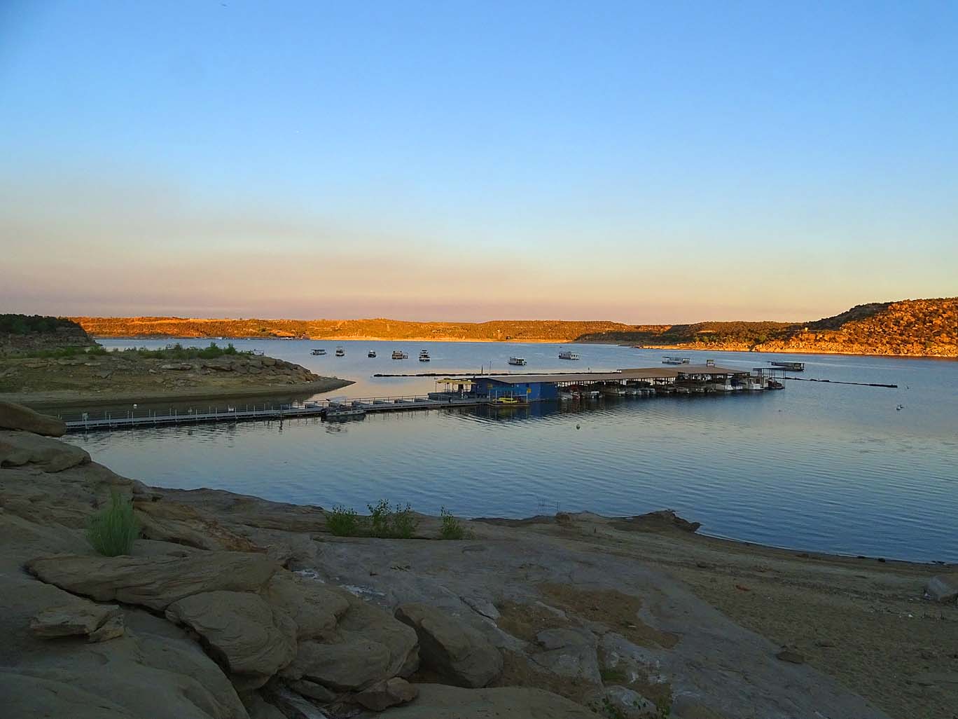
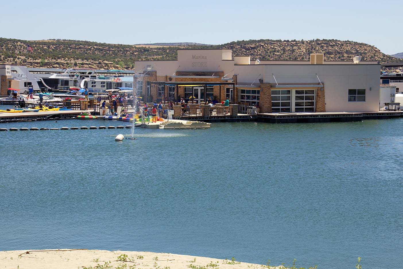
The marina was lovely with a breeze coming off the lake that would turn to wind giving a sailor a heart attack. Hence, the need for a hat leash! There was a water bumper boat area for kids of all ages with huge Koi swimming around unperturbed by the boats. These boats had water guns on the front and although the sign read “only spray other boats”, one must always be vigilant for water on a camera lens…
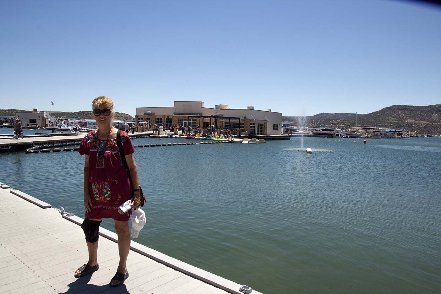


Arriving around noon, we were hungry and ate at the café on the marina deck. There were tables with umbrellas, a necessity since the temperature was in the mid-90’s, and we could watch the kids ‘bumping’ in the roped off area and the endless parade of boats being dropped off and picked up. We saw small boats for two fisher-people, Jet Ski’s, pontoons, speedboats, Yachts, and all sorts of watercraft. There were a few kayaks and paddleboards, but only a few. What we did not see were sailboats, which Patti pointed out.
Available, to rent, were houseboats sleeping anywhere from 6 – 15 people. These I do not believe, were not allowed to move about the water – it was more like a floating motel. Prices ranged from $200/night – to $65/night per person, depending on whether it was a Yacht or a houseboat. This was fodder for thought…


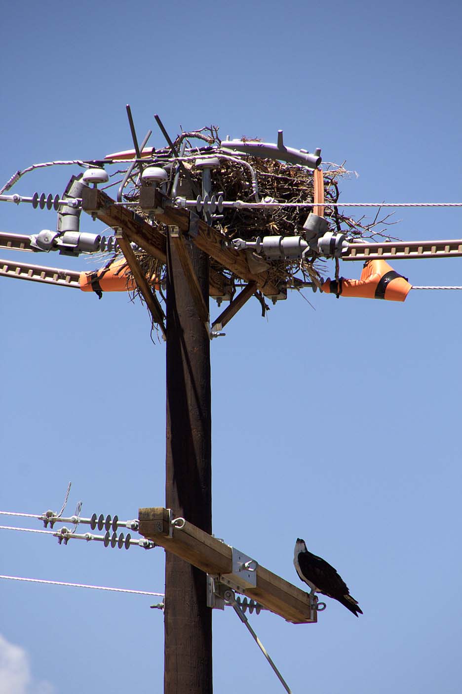
Once the wind began to pick-up in earnest, we decided to head back to the truck and head for home. We debated on which road to take back, and decided on the dirt road once again. On our way out just off the dam, Patti spied an Osprey standing guard over her nest, ever vigilant, although from our perspective, we could not see any young heads popping out of the nest. Although, only God knows why they would build their nest on a power pole!