Kasha-Katuwe Tent Rocks

History
The Bureau of Land Management (BLM) manages Kasha-Katuwe Tent Rocks National Monument (KKTR) to protect its geologic, scenic and cultural values. The agency works in close coordination and cooperation with the Pueblo de Cochiti; and enjoys a partnership with the University of New Mexico, and Sandoval County to provide access, facility development and maintenance, resource protection, research opportunities, public education and enjoyment.
The Pueblo de Cochiti has always considered this area a significant place. “Kasha-Katuwe” means “white cliffs” in the traditional Keresan language of the pueblo.
Of Time and the Rocks

Located on the Pajarito Plateau in north-central New Mexico, the monument is a remarkable outdoor laboratory, offering an opportunity to observe, study, and experience the geologic processes that shape natural landscapes. The elevation of the monument ranges from 5,570 feet to 6,760 feet above sea level.
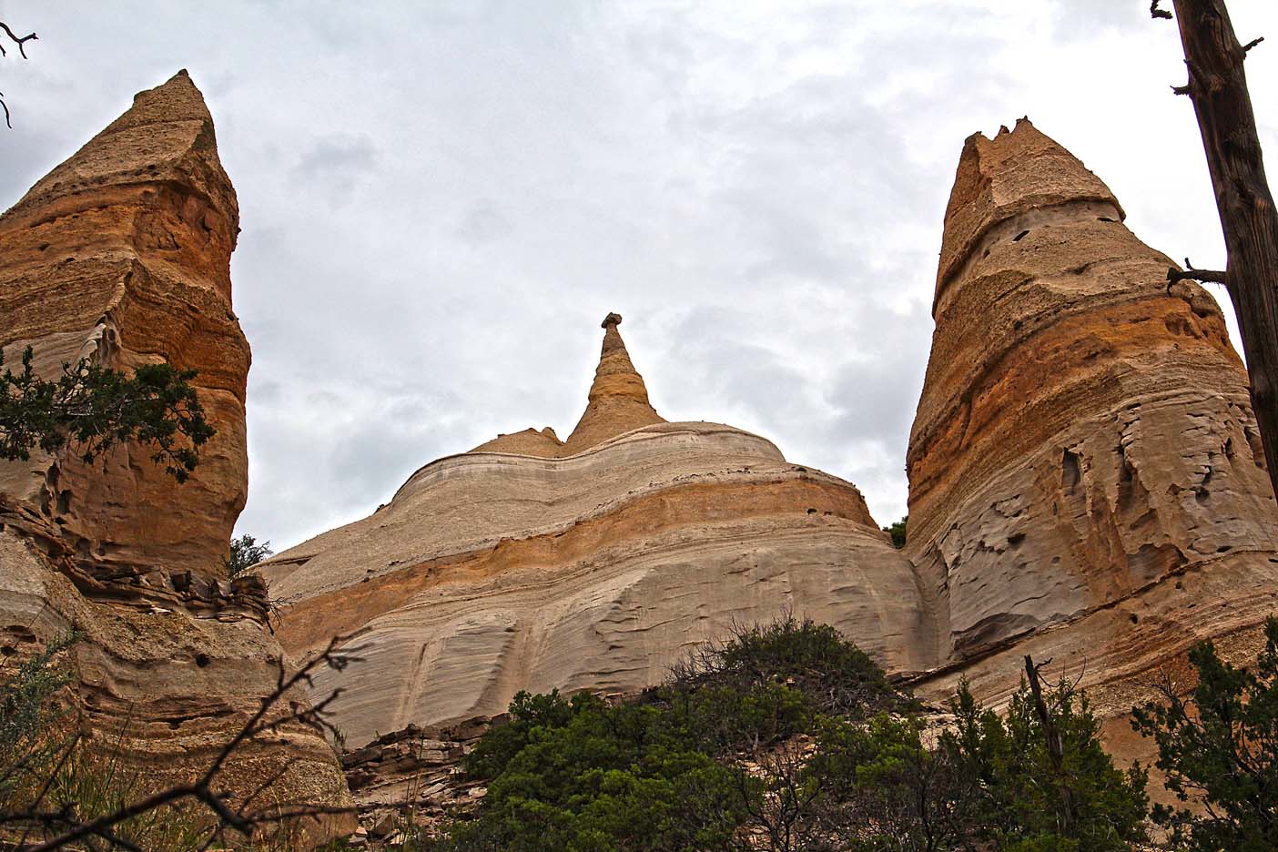
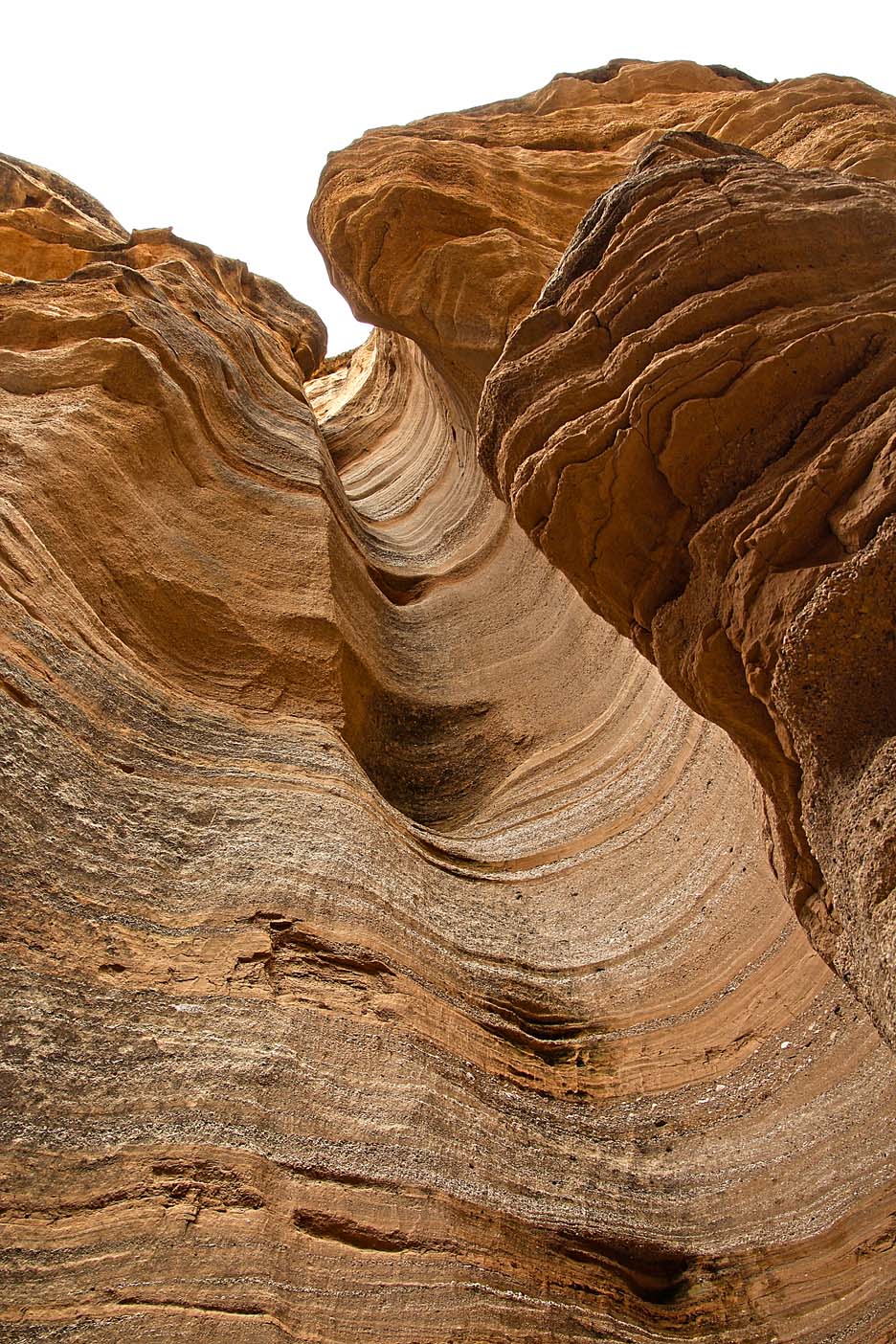
The cone-shaped tent rock formations are the products of volcanic eruptions that occurred 6 to 7 million years ago and left pumice, ash and tuff deposits over 1,000 feet thick. Tremendous explosions from the Jemez volcanic field spewed pyroclasts (rock fragments), while searing hot gasses blasted down slopes in an incandescent avalanche called “pyroclastic flow.” In close inspection of the arroyos, visitors will discover small, rounded, translucent obsidian (volcanic glass) fragments created by rapid cooling.

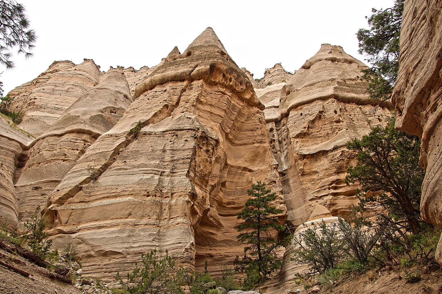
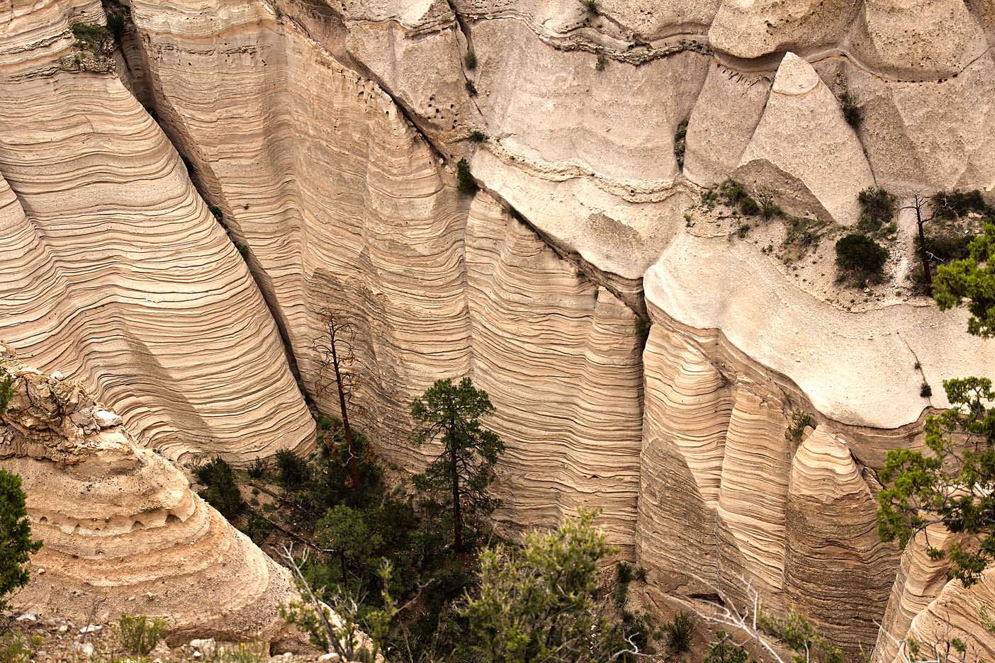
Precariously perched on many of the tapering “hoodoos” are boulder caps that protect the softer pumice and tuff below. Some tents have lost their hard, resistant caprocks and are disintegrating. While fairly uniform in shape, the tent rock formations vary in height from a few feet to 90 feet. As a result of uniform layering of volcanic material, bands of grey are interspersed with beige and pink-colored rock along the cliff face. Over time, wind and water cut into these deposits creating canyons and arroyos, scooping holes in the rock, and contouring the ends of small, inward ravines into smooth semi-circles.
Off to find the Tents
One day we saw the sign to Kasha-Katuwe Tent Rocks and decided to check it out. It is a short drive, 5-miles or so, to the entrance to the National Monument. The monument opens at 7am and closes at 7pm, at which time the gate is locked. We drove to the trailhead and I took my Camel Bak, hat, sunglasses AND camera… Patti waited with the truck, reading and people watching, as it is a steep climb to the Tents for the last ¼ mile.
The beginning of the trail is a flat and gentle walk with a view of rock layered like ribbon candy perched on top of desert landscape. The green sagebrush and overcast skies seem to make the tan of the rocks vividly stand out. There are, of course, no trash cans along the way, just signs saying “pack it in, pack it out.” Everyone complies, as there is no trash anywhere, not even a cigarette butt.


The rock layers are composed of sand and gravel that were eroded from volcanoes a few miles north, and deposited here by flash-flood-prone streams nearly 6.8 million years ago. The layered colors represent buried soils within sedimentary deposits: pumice and ash.
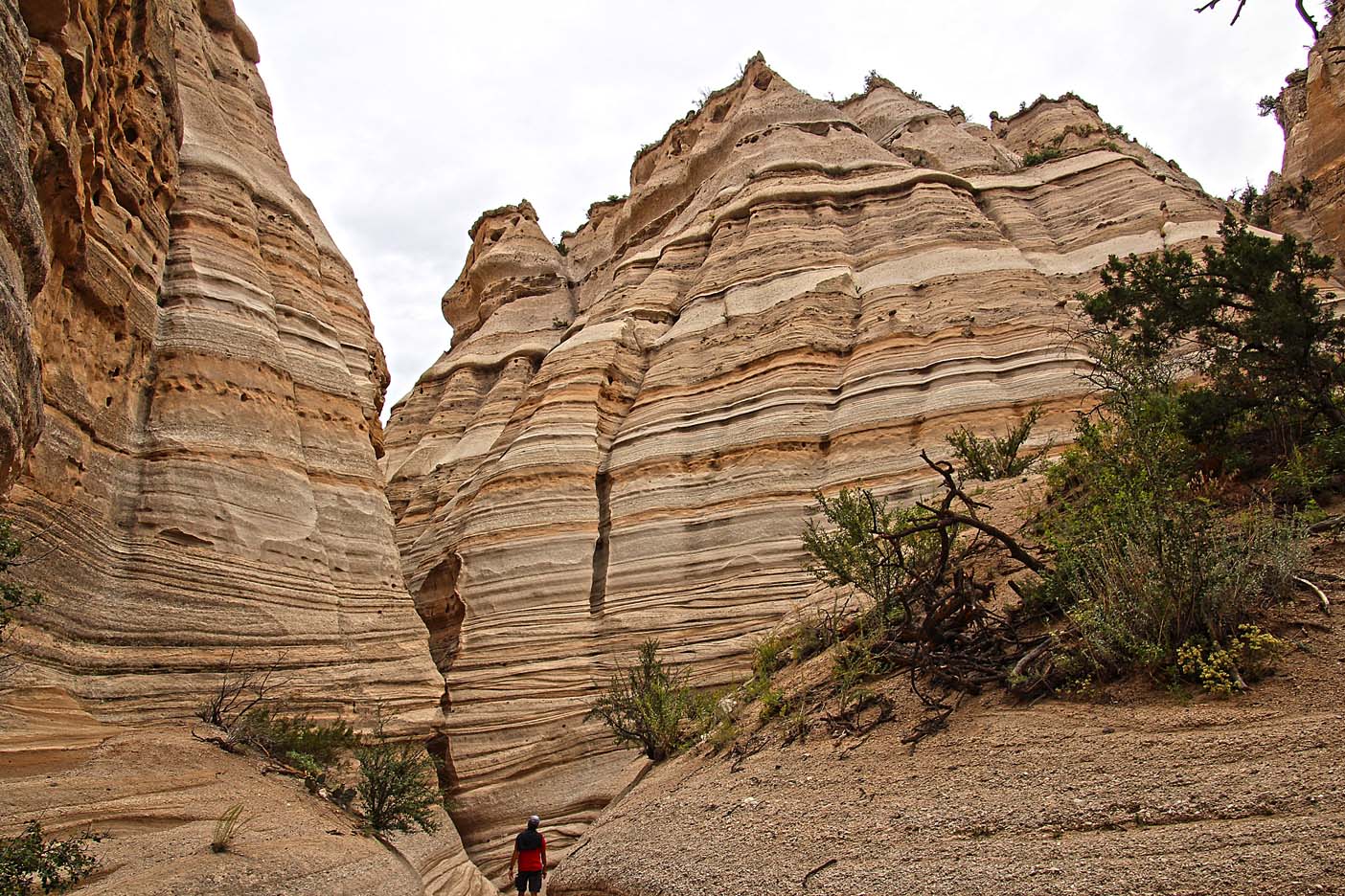
As I walk on the flat plains, narrow walls begin to form into canyon walls. The ribbon effect continues but now spectacular designs embedded in rocks dominate the view. Further up the trail, you can see how the water and wind eroded the soft rock and left a ponderosa pine with its roots digging deep into the soil below seeking water.


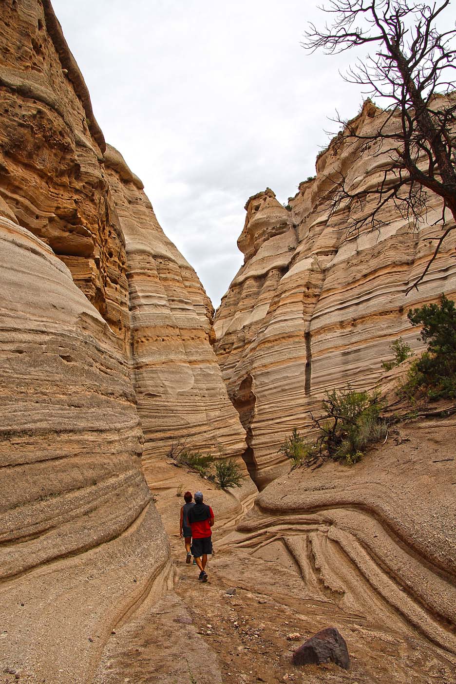
Just a ways up, the walls steepen and the trail narrows even more – forming the Slot Canyon. At some points in the journey you need to climb over or under huge boulders that fell from the steep walls into Slot Canyon. It seems like a maze at some turns and you wonder if you will get lost? No way. The only way out is through the Slot Canyon or straight up and over the walls. Occasionally, in the canyon there is only enough room for one foot on the path and other times it’s stepping over roots and under fallen trees. Beautiful and serene!


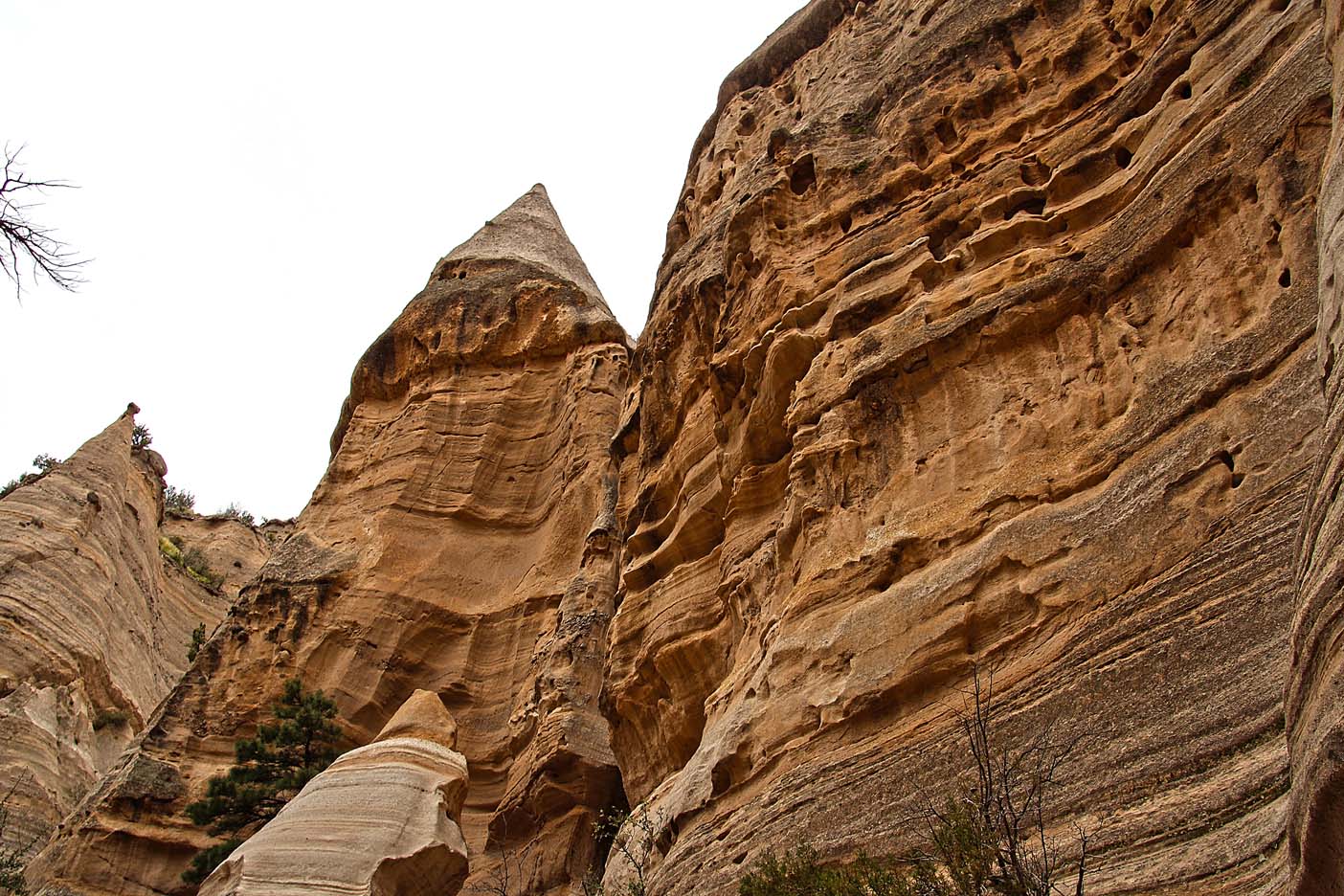 Then… the ‘tents’ start to appear. They almost look like someone chiseled or sculpted the rock trying to make an artful statue. Maybe Leonardo DaVinci practiced on these rocks, before he carved David!

The Tents undulate from one to the other in a magnificent windswept pattern only Nature could design. I loved how the trees just snake their roots to find dirt to stabilize their height and bore down to find water to sustain their life force. The will to live!!!

Upon leaving the canyon, there is a steep ascent to the top where the view is breathtaking. It is a panoramic view of the Jemez Mountain Range, Cochiti Lake and countless other vistas with unknown names.

These Tent Rocks are very unique to this one specific spot and the only other place in the world that has these sculptured ‘tents’ is the country Turkey. There were many tourists on the trail today, and everyone seemed to be in awe, as was I. Many times on the trail someone would have to wait for the people going up to pass because there was only room on the trail for one person at a time. No one hurried anyone else and everyone was also careful not to ‘photo-bomb’ anyone else’s pictures. I did however take some pictures with people in them, deliberately, so that a perspective could be seen between the people and the height /depth of the rock formations.

After enjoying the magnificent view, resting, taking photos AND drinking water, it was time to descend, especially since dark clouds were beginning to form. I would not like to be in Slot Canyon in a flash flood, and as it was still the season of flash floods I began my descent back to the truck and Patti. As much as the ascent was tiring, it was actually easier to go up than down, at least for me. When I get tired I tend to stumble and with the soft path and loose sand I had to be extra careful coming down.
At last, I made it down without incident and taking very few pics – for I had taken over two hundred on the way up! What else could I possibly photograph? By the time I got back to Patti, my neck was kinked from looking up so long in awe…


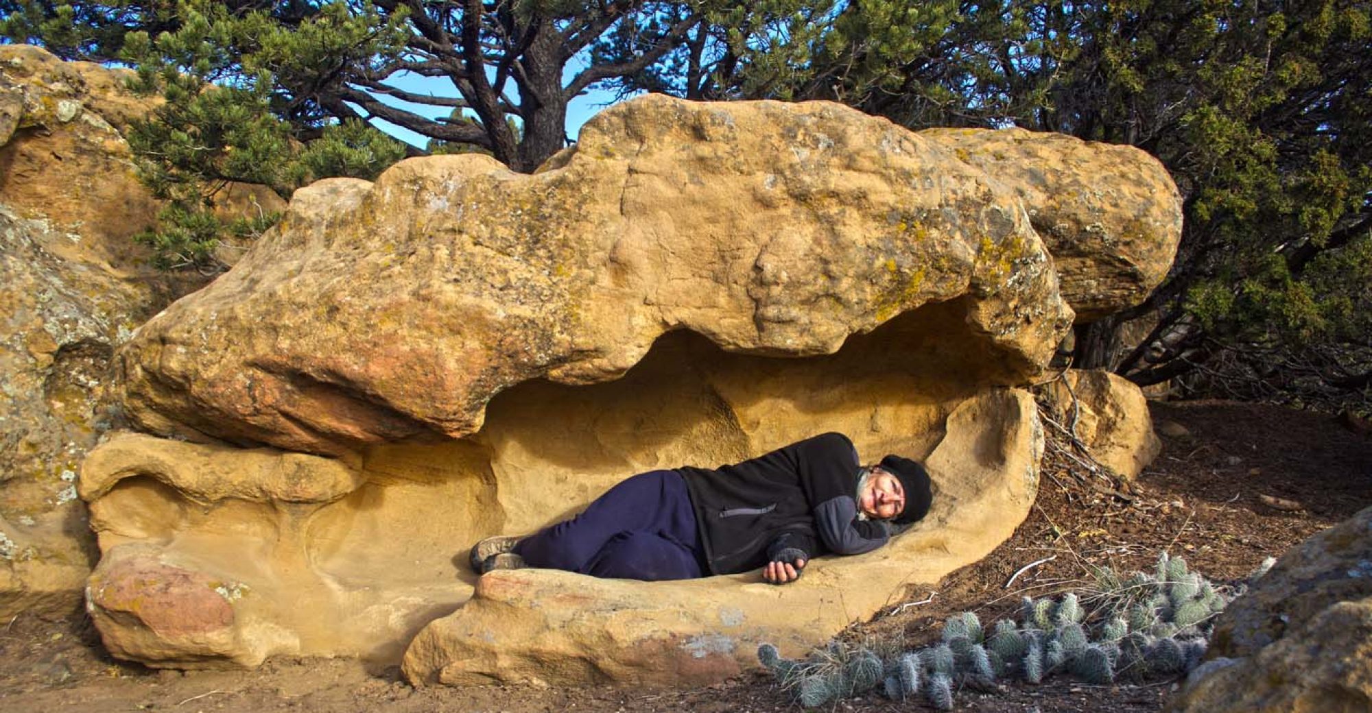
There was a cave after I returned to the beginning of the trail that was on a different loop than the Slot Canyon trail. It was a hollowed out small cave where you could see the fire remains on the ceiling of the cave. We were not allowed to venture inside the cave and it certainly was not big enough to live in like the Gila Cliff Dwellings, but it was an interesting contrast to the Tent Rocks.


Patti wanted to go to the Veterans’ Memorial Scenic Overlook, in the park, but it was closed for a few days while crews cleared deep mud off the road from a flash flood a few days ago. So that will have to wait for another time.
This National Monument is open year round and would be interesting to visit in the winter. It did appear from a few pictures on the brochure that snow does happen in this area. Tent Rocks is truly a magnificent place to behold Nature at her FINEST. Come and enjoy the uniqueness of this wonderland!

Hi, great photos and narrative. You mentioned that the only other place was Turkey…,I remember seeing them in Canada, near Banff. I’ll see if I can find a reference. Thanks. Chris
LikeLike
Thanks, I’d love to know if they also exist in Canada.
LikeLike
Looks like an amazing place 💫
LikeLike
What a spectacular find! You always seem to come across the most remarkable places! I’m so glad you take the time to document your journeys through pictures and stories. I think one day Todd and I would like to be nomadic (at least for a period of time). Big Love & Hugs to you both!
Robyn
LikeLike