August 18, 2017
History
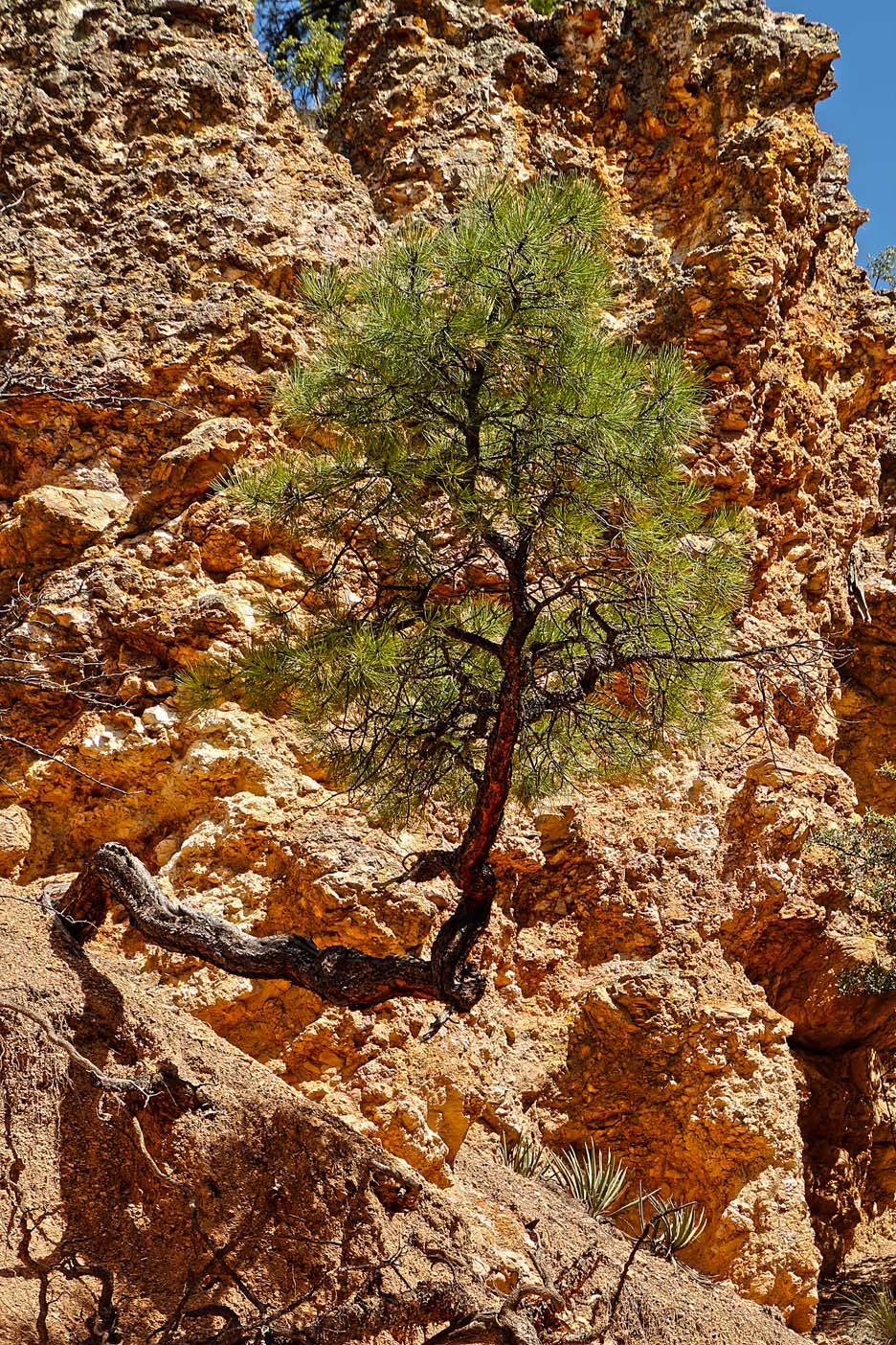
The Monument landscape ranges in elevation from around 5,700 to 7,300 feet above sea level and follows the branches of the Gila River. The terrain around the ruins is rugged and arid, and contains steep-sided canyons cut by shallow spring rivers, and mesas and bluffs forested with Ponderosa Pine, Gambel’s oak, Douglas fir, New Mexico juniper, pinon pine, and alligator juniper (among others). The area geologic history stems from the Oligocene epoch and volcanic activity that subsequently covered the area with ash. The Monument’s hot springs are remains of this volcanic history.
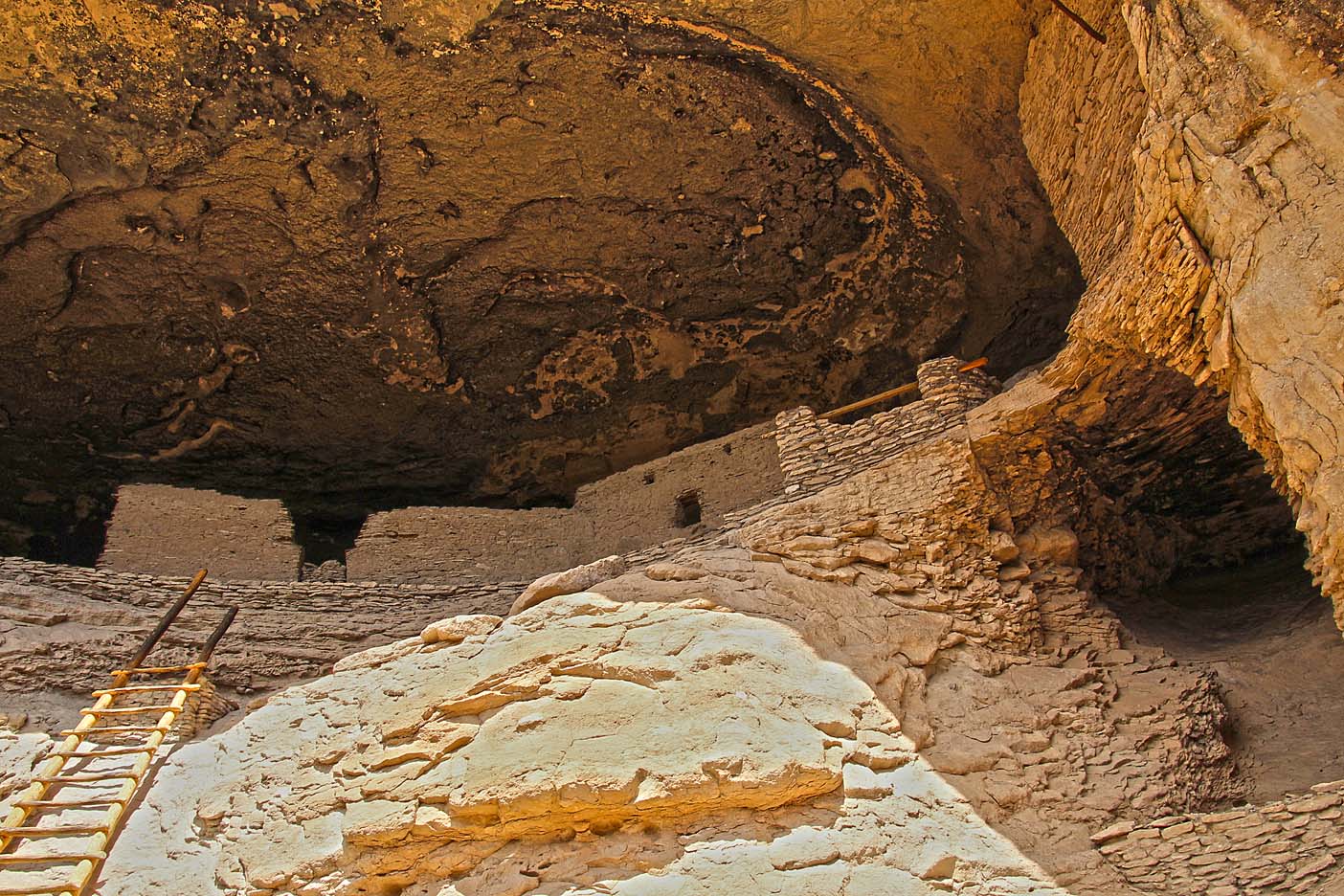
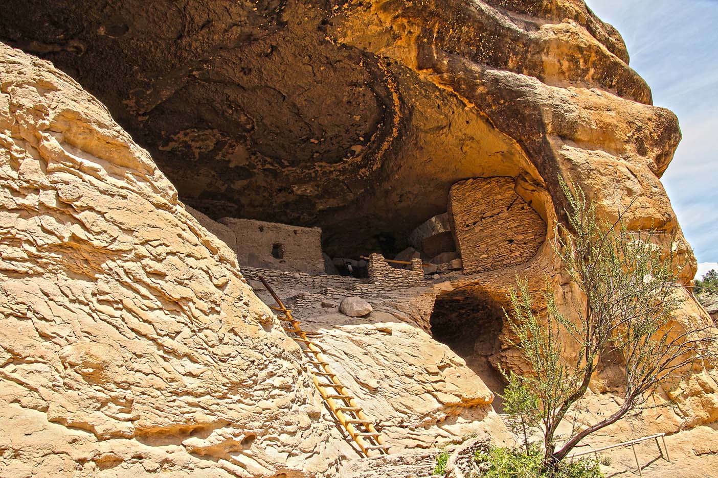
The Monument consists of 554 areas and contains the remains of a Mimbres Culture community in various locations, two of which are most prominent. The namesake ruin developers made use of natural caves to build interlinked dwellings within five cliff alcoves above Cliff Dweller Canyon. The TJ Ruins are located on a bluff overlooking the Gila River. The Mogollon Peoples are believed to have inhabited the region from between 1275 and into the 14th century, during the Pueblo III Era.
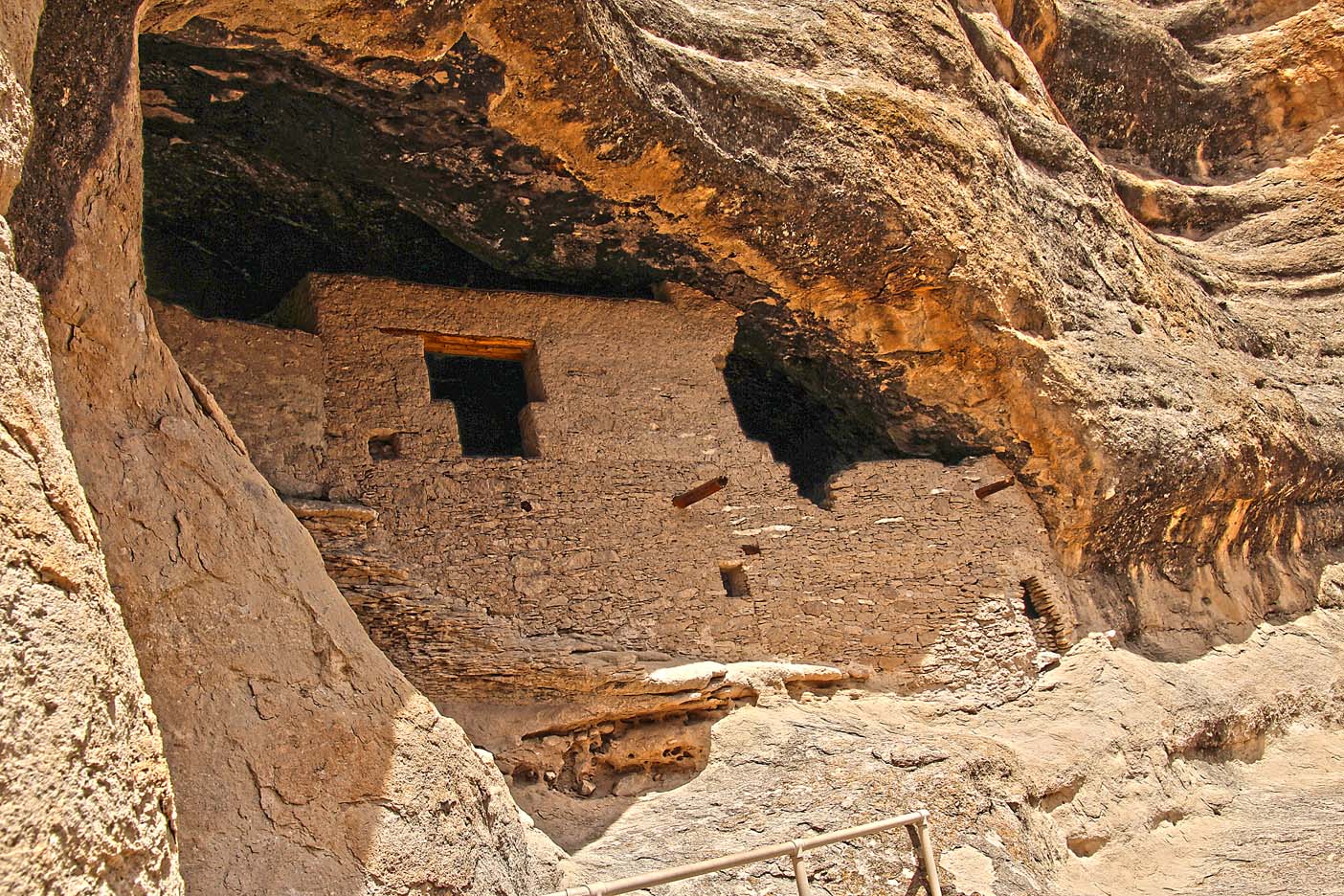
Archaeologists have identified 46 rooms in the five caves on Cliff Dweller Canyon, and believed they were occupied by 10 to 18 families. It is not known why the community was abandoned.
This Mogollon mountain home, now preserved in Gila Cliff Dwellings National Monument, was abandoned by A.D. 1300. Our knowledge of the people who inhabited this remote place is based on years of archeological examination of the crumbling buildings and scattered artifacts they left behind. Theirs was but a brief chapter in the long natural and human history of the Gila Wilderness area of southwest New Mexico.
Thousands of years before the Mogollon (MUGGY-own) lived here, this mountainous wilderness had assumed much of its present shape. The narrow gash of Cliff Dweller Canyon was carved into a gently sloping mesa by a perennial stream that empties into the broad floodplain of the West Fork of the Gila River. Flowing southeast from its headwaters in the towering Mogollon Mountains, the West Fork joins with the Middle Fork and East Fork southeast of Cliff Dweller Canyon and from there the Gila River cuts a deep, tortuous path through the Diablo and Pinos Altos ranges before reaching the broad grasslands of the Gila River Valley toward the Arizona state line.
Our Trek to the Dwellings
We went to Elephant Butte, where we thought we would be giving Patti her long awaited quiche fix, but alas it was their annual vacation so they would be closed till August 29th. That would be entirely t-o-o long for us to stay in this area, as the temperatures were an unsavory (up to) 99 degrees. So we decided to stay a few days and take in the Gila Cliff Dwellings National Monument, as we missed this monument the last few times we were at Elephant Butte. Although Patti was very disappointed in not being able to get her quiche, she was happy to tour the dwellings.
We headed out of Elephant Butte by 7:30am for the long drive to Gila Cliff Dwellings. We made sure the gas tank of the truck was full before we started, as we knew there would be no gas stations on our way. There was actually a sign at the beginning of our adventure that stated: no services along this route.
Although the Cliff Dwellings were only 120 miles from Elephant Butte, it would take us 4 hours up and 4 hours back to make this trek… a whole days journey.
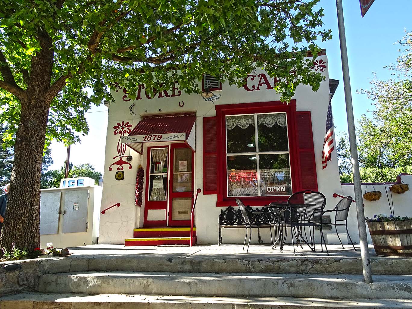
Elephant Butte is a huge reservoir/dam (the largest in New Mexico) on the Rio Grand and because it resides in the lower part of NM (right off I-25) it is considered an arid or desert landscape. However, as we proceeded to climb up HWY 152, about 20 miles, we encounter Hillsboro, a revitalized mountain ghost town. Hillsboro now has a small art community, an old fashioned café with homemade, downhome cooking, and ruins of a bygone era. We have eaten at the café before, but not this trip, for we were on a mission to get to the Gila Cliff Dwellings.
All along the way from Elephant Butte there were highway signs that warn of single lane bridges that have a maximum height of 12’ 8” and once you get past a certain point there is no turn-around for large trucks. These bridges (for there are 2 of them) are just outside of Hillsboro and span two small ‘grand canyons’. The bridges look like old metal railroad bridges you might have encountered along Route 66 in days past. Depending on the time of year there is some water flowing at the bottom of the ravine. Luckily, we were not pulling Rosalita for we had been warned that this road is not a nice road for travel trailers, etc. The road is steep in places with many 6-7% grades and sharp, almost, u-turns.
Along this route is another revitalized, although much smaller, ghost town, Kingston. We have only driven through this town so we have no idea what they have to offer.
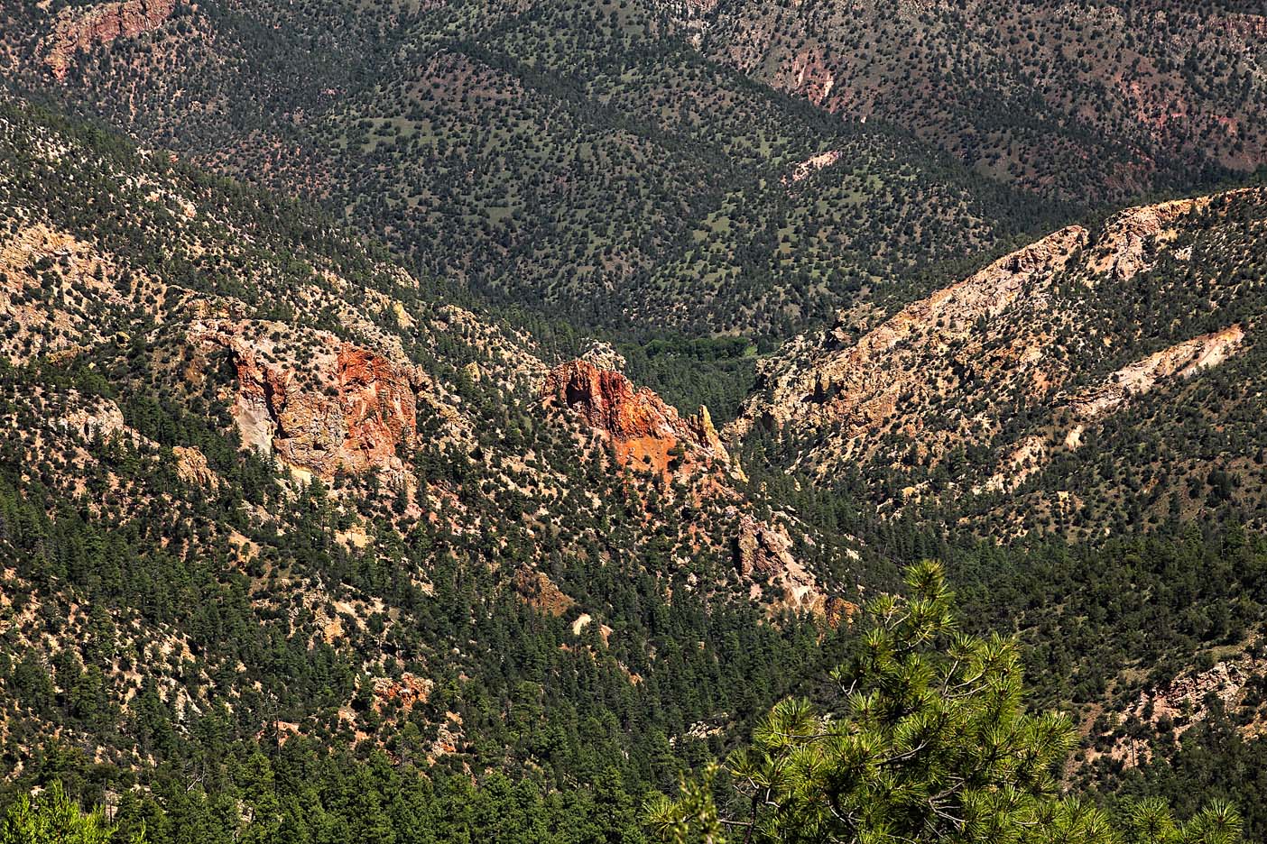
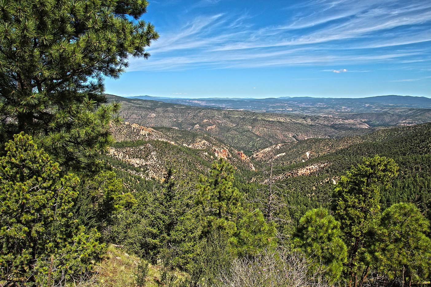
As we leave Kingston, we continue our ascent winding up the steep/curvy grade of the Mimbres Mountains, leaving the cactus and sand of the desert behind. It begins to look more like Colorado. I almost always compare all mountainous terrain to Colorado – my first love of mountains.
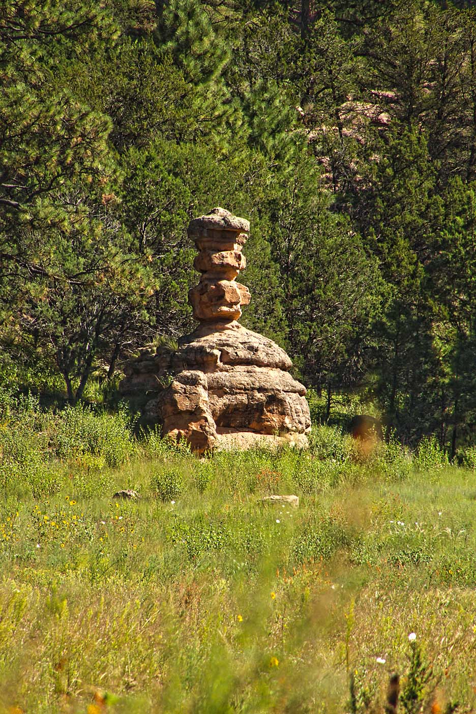
The landscape is filled with green… many shades of luscious green: the green of the Ponderosa Pine, the rich deep green of the NM and alligator juniper, the silver green of the myriad bushes that shade the earth, the soft green of the wild grasses, and the stark contrast of summer wildflowers.
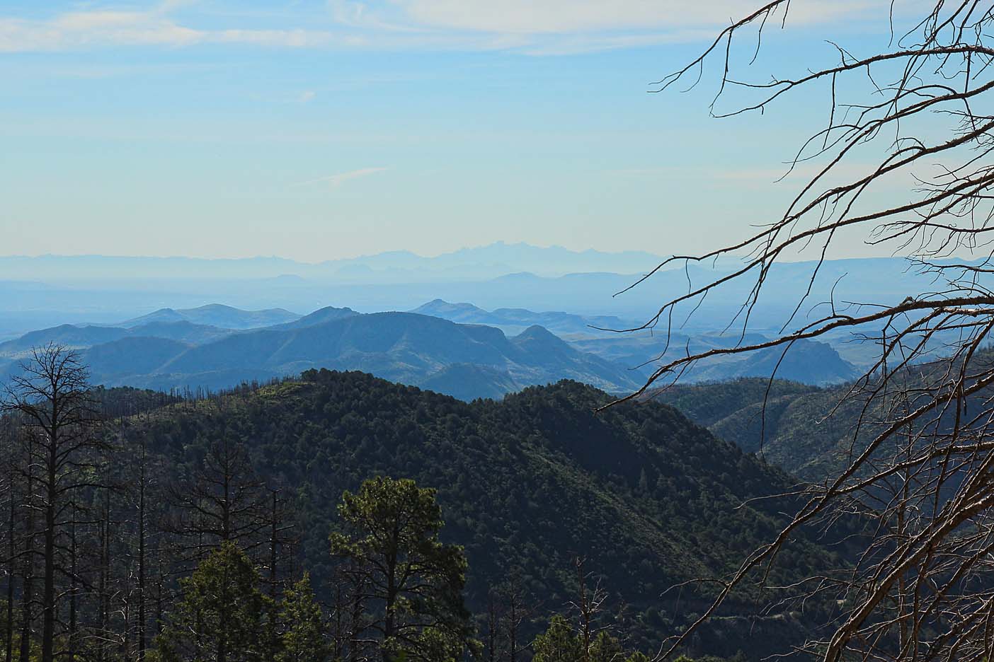
We do not reach the 10,000’ elevation required to be in timberline (where trees no longer flourish and grow) as the Seven Brother Mountain peak is only 8,547’. Along the way there were portions of the forests that have been killed off by pine beetle – leaving stark grey stains among the green backdrop of the forest.
The drive includes very few houses or cabins, some streams that crisscross under the highway and give us mountain music when we stop to admire the views.
We then descend on the other side of the Mimbres Mountain range and pass through the last town, San Lorenzo. We see a sign for Lake Roberts in Grant County. This lake is fed by Sapillo Creek and is a 69-acre lake created in 1963. It is a mountain community with cabins, retreats, and an expensive general store (one 7-Up is $2.00)! There is camping, plus fishing for trout, bass and catfish for those so inclined. We will stop to check out the lake on our way back from the Cliff Dwellings.


Again, we climb up another circuitous route back and forth – up and down till we reach an overlook into a fertile green valley, the Gila River Valley. The dwellings are about 5 miles in front of us, but not within view as yet.
Driving down from the overlook we reach the valley floor and find ourselves at the base of the Diablo Mountain Range and the headwaters of the Gila River.

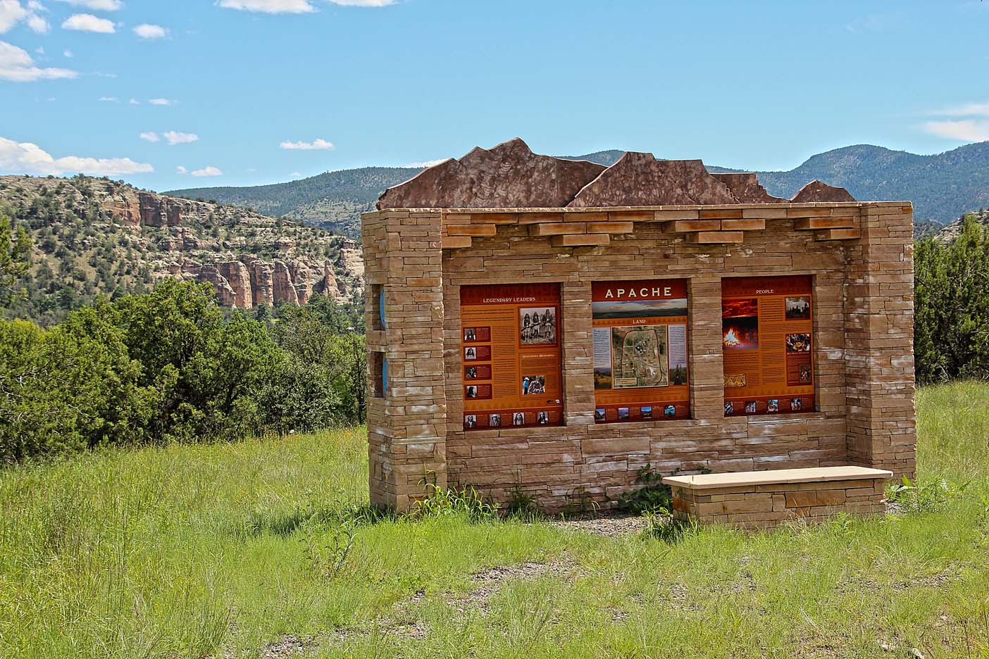
Stopping at the visitor center, we buy a few souvenirs to support our National Parks and pick up maps and info on the area. Now it is: up to the Cliff Dwellings.

Once at the trailhead, I park the truck in the shade (today the high will be 93 degrees) as Patti will remain with the truck because of her wobbly knee. The Ranger tells me as I begin my trek: NO food of any kind or flavored drinks are allowed into the monument… only water is allowed. They had a cooler of ice water for people to fill containers, if need be. I had my Camel-Bak and we always carry a gallon or two of water in the truck. You are not allowed to pick any flowers, wood or rocks you might want for remembrances either. These rules were important and I, as well as the people I met along the way, adhered to them. There was not a speck of trash or litter along the trail! “Pack it in – Pack it out”
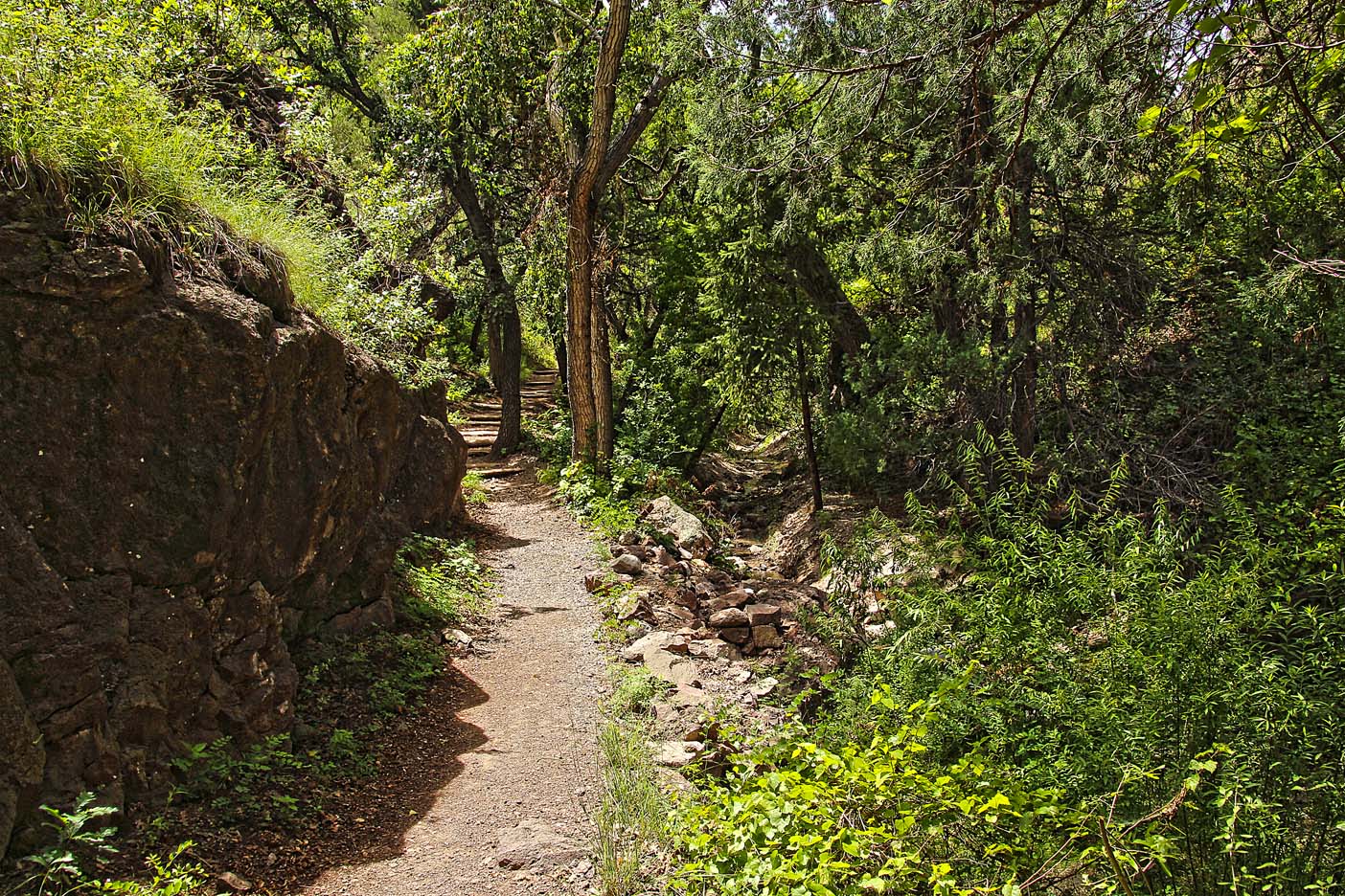
At the beginning of the trail was a long wooden bridge over the Gila River, which was more like a stream at this time of year. The dirt path was at the bottom of the canyon and shaded with trees with steep etched (by eons of water and wind) rock walls on either side. Along the way there were smaller wooden bridges that allowed the stream to crisscross underneath the trail.


The hike up to the cliff was mellow and shady until the last ¼ mile and then turned into a steep switchback trail in full sun. I did have plenty of water and my trusty hat for protection, as sunstroke is not fun!
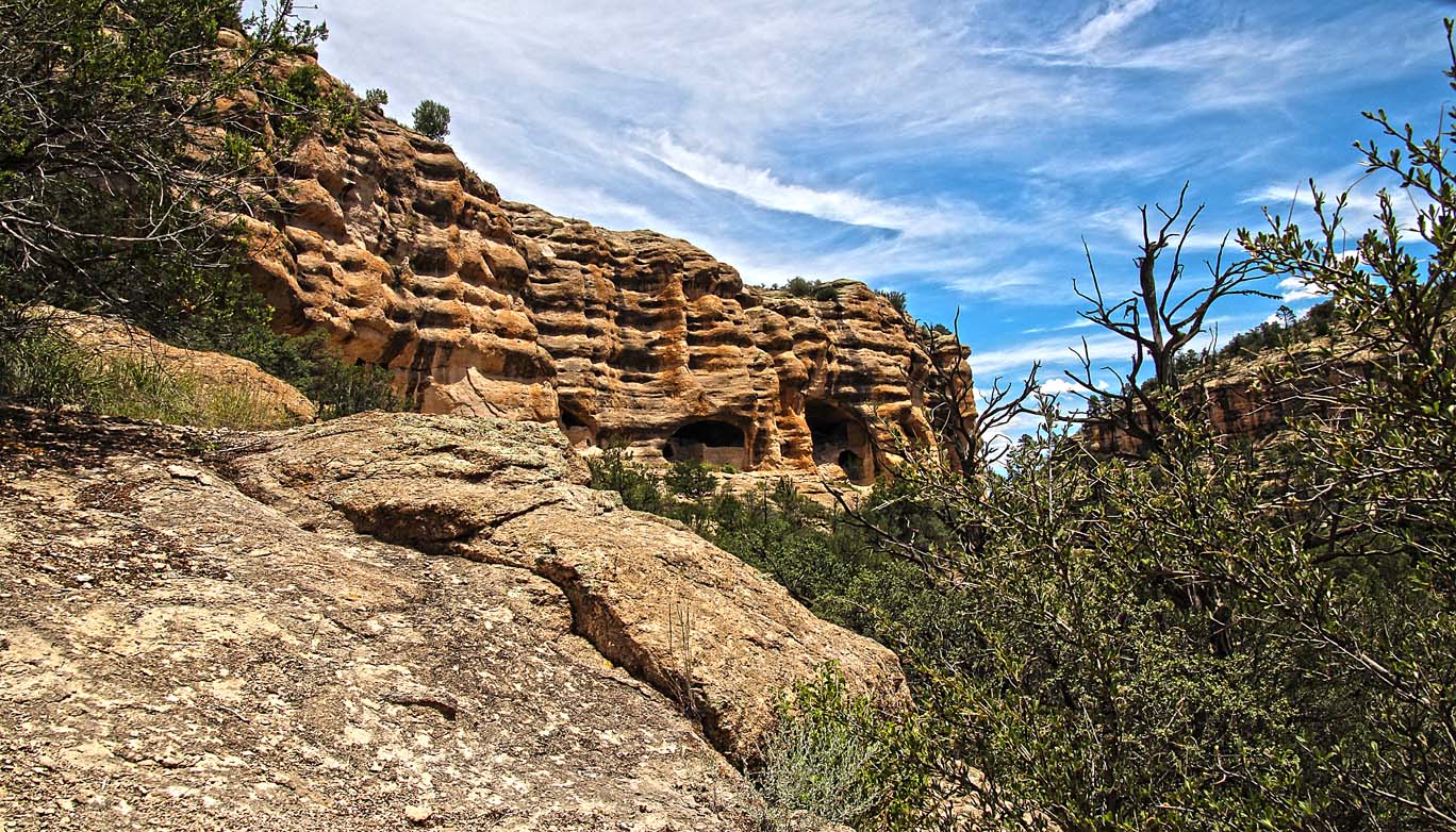
All along the way the dwellings played peek-a-boo coming in and out of view in the landscape. Then the Gila Cliff Dwellings loom up before your eyes in all their entire splendor.


As I approached the caves a tour was in progress with the Ranger explaining the history of the place and people, the Mogollon people. The guide tells me I can join the tour or proceed by myself. I choose to go it alone because if you’re with a group – the people are always in your pictures. I jump ahead of the tour, knowing I will double-back to get the pictures of this area after the tour moves on.

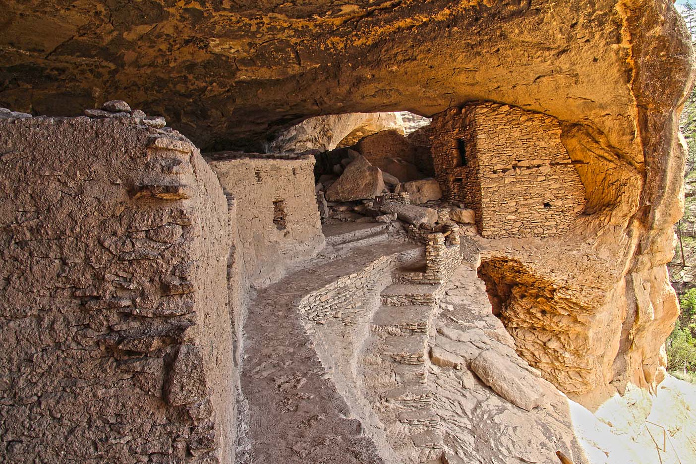
Upon first viewing the ruins, it seems there are only 2 big rooms with adobe walls inside… But once you are at the actual site there are multiple caves with several interior rooms each. These are not separate caves, as they all seem to be interconnected by hallways, like condos with out walls. Even after you encounter these first rooms, there are more caves around the corner, unseen at first.


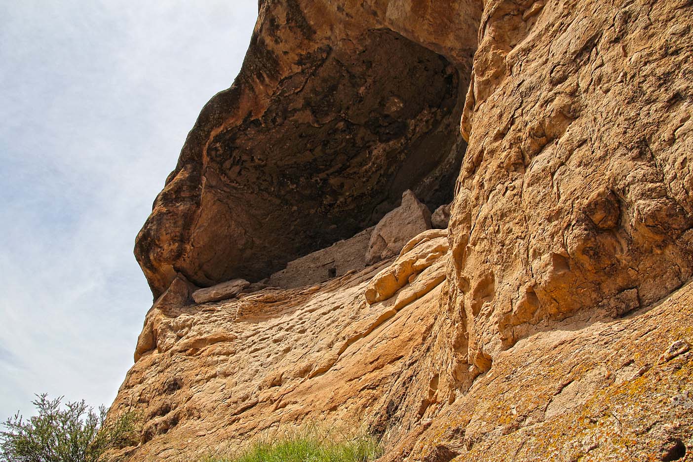
The caves are 200’ +/- above the canyon floor which is a long way to haul water, dirt for adobe, or supplies up to the entrance. They must have been very physically fit people, as there were no elevators or any evidence of pulley-type hoist systems. No handicap parking or wheelchair entrances…
In each of the large caves there was evidence that these rooms were where they had their gatherings, as the ceilings were charred by many fires from when the people sat around smoking the peace pipe, sharing stories and deciding what was for dinner. The openings to the caves were perfectly oriented for solar gain. In the winter with the sun at the lowest ebb on the horizon, the placement let the sun shine in to warm the interior. In the height of summer (NOW in August) the sun, at it’s apex, would not be able to penetrate the caves keeping the temperature at least 15-20 degrees cooler. It was a very nice cooling respite to hang out in the caves on this 93-degree day; especially after the hot climb in the sun at noonish. This tribe, from the late 1280’s to 1300’s, was much smarter and forward thinking than the fossil fuel consuming madness of today, in terms of harnessing solar energy!!!
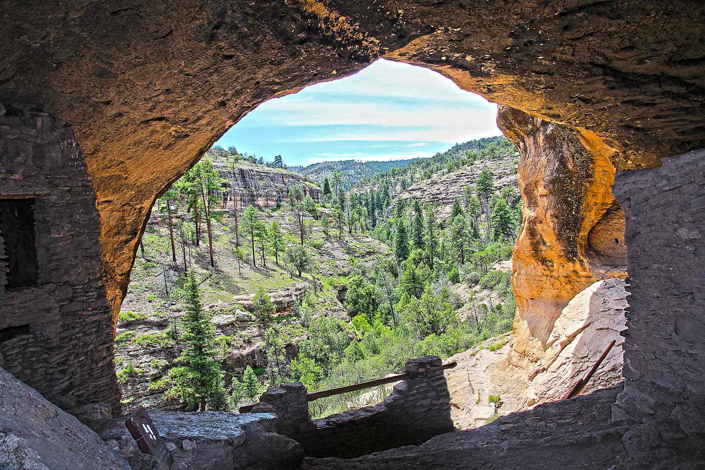
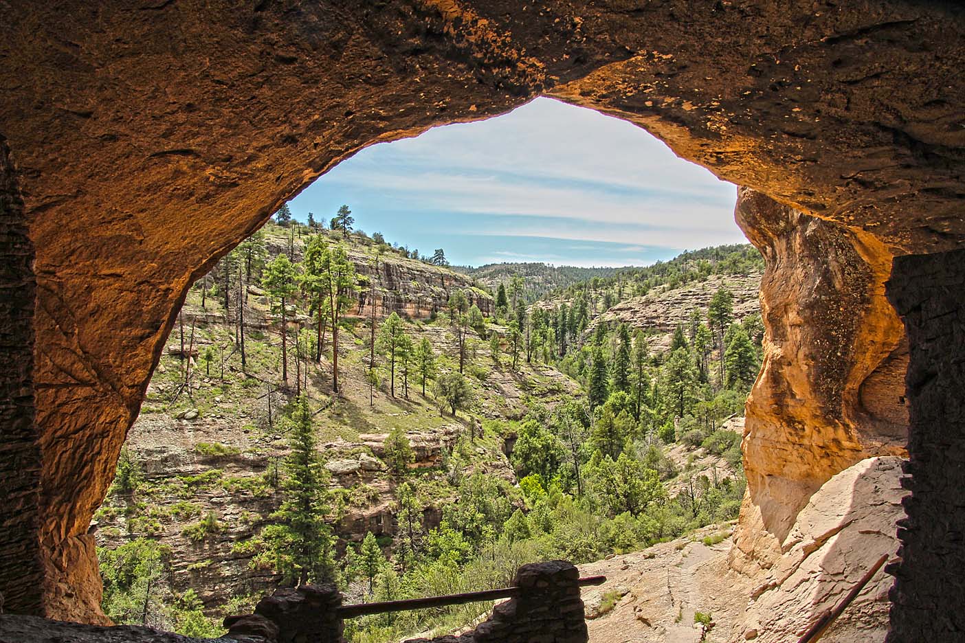
We were able to enter the caves and climb up ladders to experience the energy and fantasize the goings on of these people, but we were not allowed into the individual rooms or great meeting rooms, so as to protect the fragile ecosystem of a lost heritage. The views from the mouth of the caves were spectacular and their construction ingenuity was mind-boggling. I felt at home in these caves, as if I had been a part of the Mogollon tribe… was I???