September 16, 2016
By the time we started driving (out of Granville – with even more tomatoes in tow), it was probably going on 10am. By this time the rain had started again, but heavier now. We pulled Rosalita east and sadly, brought the rain with us. On our way to Rugby, ND for gas, we drove in and out of raindrops every few miles. At one point we hit dry pavement and thought we were in the clear. No, the drizzle and light downpour would follow us all the way past Rugby.
Rugby, ND
The town of Rugby was familiar to me, or at least the name, and I had to dig deep to remember why. After a few minutes, I realized, Patti and I had listened to an audio book, “The Oldest Soul,” on our way out of town a couple of weeks ago. The story line takes place in Rugby, ND, which is the “Geological Center of North America”. I had not heard of this Geological Center ‘stuff’ before; but now we know the author did her homework, for it truly exists. When we were first deciding to come east through North Dakota, I asked Patti if we would pass through Rugby on our way east? Then we both forgot all about this town. Amazing, the synchronicity that life offers sometimes.

We had to stop and check Rugby out… even despite the drizzle still coming down; after all we would need fuel anyway. There is a stone monument, where the exact spot of the Geological Center of North America is located.


Prairie Village Museum
In pretty much the center of Rugby, is the Prairie Village Museum, so we decided to check it out. The museum is a “step back in time” with buildings from a bygone era filled with relics at every turn. There are 27 buildings ranging from livery stables/blacksmiths, library, phone office, railway station, school, dentist office, saloon, church, etc., etc., etc. Each building type was ‘staged’ with antiques for that trade. I would imagine people donated these relics to the museum, just to have them not get lost or buried on the farm. A few pictures are next…

At one point, the rain started coming down harder than a drizzle, so we paid for our souvenirs and headed down the road toward Devil’s Lake. The wet, soggy drive out of town made all the fields of green and tan look so vibrant. I was sorry that there was no way to pull Gypsy & Rosalita off to the side of the road to snap a few pictures. Not only did we see lush fields, but also ponds, small lakes and water fowl at every mile, oh yeah, and cows.
Devil’s Lake, ND
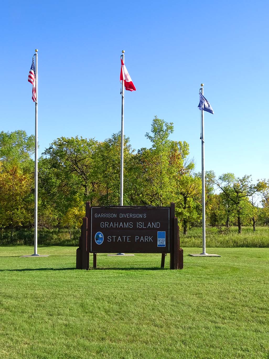
Our camping destination for the night (and maybe two) was Graham Island State Park, by the town of Devil’s Lake. I’m not sure if there is a Devil’s ‘Lake’ or if it is just the name of the town? But we shall find that out before we leave… Nor do we know if there is a devil in the lake?
The rain had let up again, but the skies were not sure they would cooperate by depriving us of more rain or not. We were lucky that it had stopped so that we could separate truck from camper and pray for sunny weather. We were surprised at how many campers were in the park, I guess fishing and camping ‘trumps’ rain any day. Although it is harvest season (corn, sunflowers, hay and veggies +++) and the moisture will definitely make it hard on the reapers, the rain sure makes the colors jump out at the eye. Can’t wait till morning to see the freshness of the colors, and the air so squeaky clean; that you can’t miss with a PhotoScape picture.

See you bright and early tomorrow…
How Devil’s Lake got its name…? When the white settlers were moving into the area, they learned from the local Ho-Chunk tribe, that their name for the lake, roughly translated, meant “Spirit or Holy” Lake. So you can see how with a little misunderstanding, the name “Devil’s Lake” came to be. The Ho-Chuck meant it in a good way, the translation took a more sinister turn… there are, of course, other renditions, this is the one I choose to include in this blog.
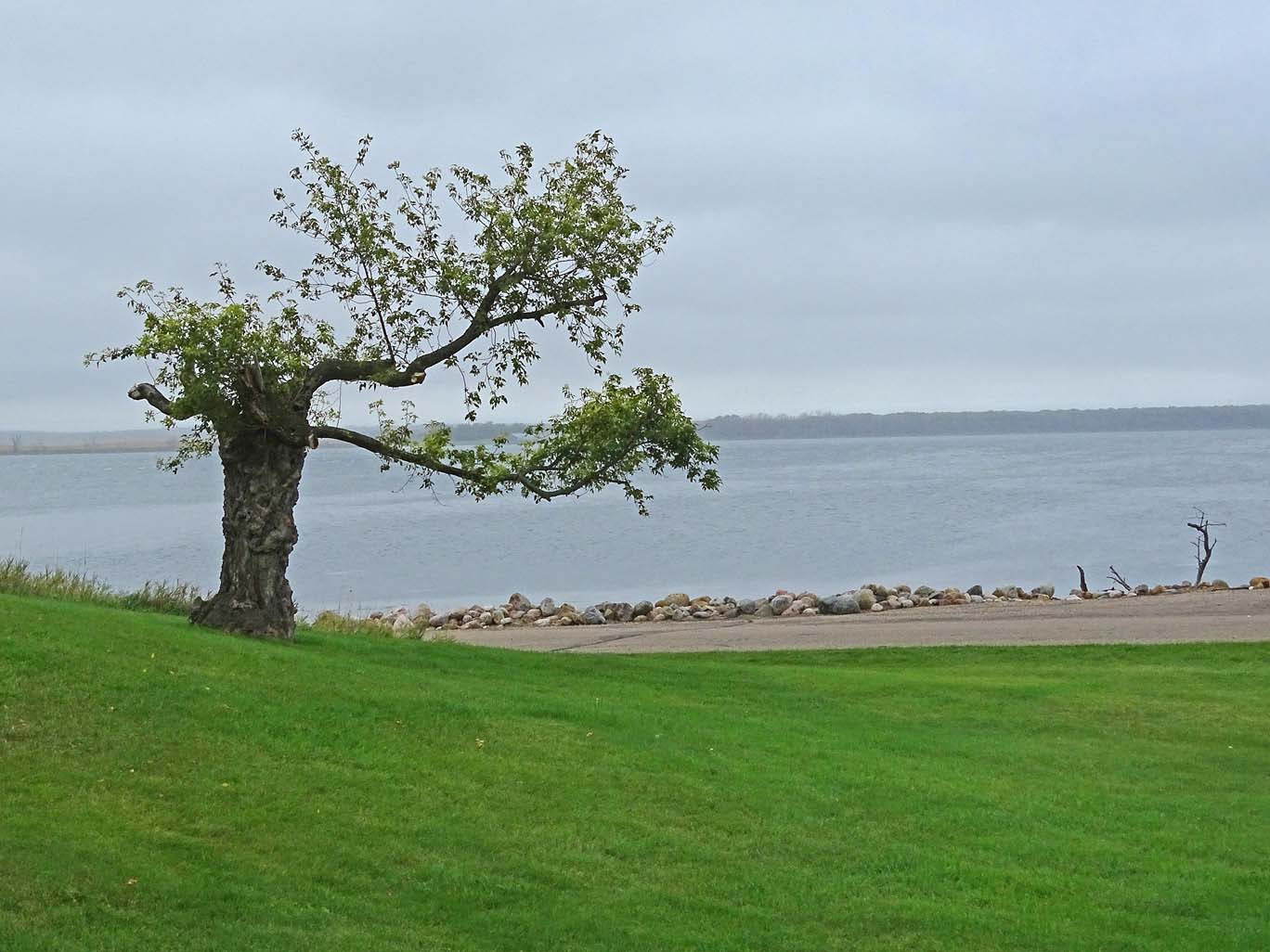
Graham Island is an island – as most of this part of North Dakota is becoming: for the last 20 years the water level has risen 30 feet which has eaten up a lot of farm land and farmers are having a hard go of it because of all the rain. For one foot of water rising, it swallows about 15,000 acres of land! Since ND is mostly flat… there is nowhere for the water to go, just forming lakes and bogs. A lot of money is currently being spent shoring up the land masses and highways.
Graham Island is surrounded by Devil’s lake (yes, an actual lake with that name); a huge lake, rivaling anything in Colorado, Arizona, and New Mexico. Sometimes you cannot even see the far end. This lake is the largest natural body of water in the state of ND and it collects around 86% of this basin’s water runoff. The catchment area is 3,810 square miles.
Devils Lake has long been known for fishing and other watersports. It has been named the perch capital of the world. Also fished in this lake are carp, walleye, northern pike and bass. It seems everyone in the local area has a boat and uses it every weekend. “If you live in North Dakota, it is a requirement to like fishing, otherwise move on.” Just kidding…

Back to camping…
Grahams Island is an oasis in the flatland. The camping area is well manicured, the staff and hosts are very friendly and helpful, and it is a beautiful and quiet spot of heaven. It has all the amenities; electricity, water, bathrooms with showers and a separate primitive tent site (primitive in the sense that there is no electricity or water at the site – but NOT primitive in relation to it’s beauty). There are even some spots that have a lake view.
We set up camp, unhooked Rosalita for we will stay 2 nights at this lovely site. The rain slowly wound down as we ate our lunch and, hopefully, tomorrow the sun will come out!
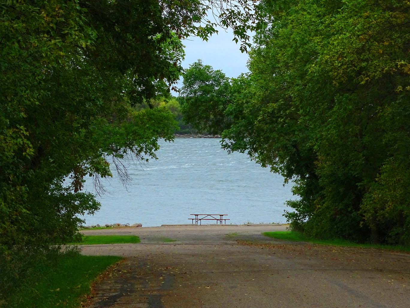
The next morning, the skies cleared and it warmed up so I took a stroll to check out the lake and landscape for photo ops. Later in the day we took a daytrip to Sullys Wildlife Preserve.
Sullys Wildlife Preserve is outside of the town of Devils Lake by about 19 miles. The road parallels the lake and is closed at sunset (about 8pm). We drove around looking for bison, elk, deer, or even prairie dogs, to no avail. But we did see a blue heron. A fence that is at least 10 feet high and probably higher secures the preserve, don’t know if the fence is to keep the animals in or keep us out… You are not allowed to get out of the car, except for designated areas. We stopped at the visitor center to get some information and have our picnic lunch, with a view of the lake. Every landmass in this part of North Dakota seems to be surrounded by a lake or water. This was a beautiful drive even though we did not see any wildlife.
Back at camp, we had a nice campfire as we watched the sunset and the Harvest Full Moon rise over Devils Lake. Alas, we have miles to travel tomorrow so as the embers of the fire slowly turn to red, we put the fire out and put ourselves to bed for an early start tomorrow. Turtle River Campground, ND here we come…

